Landscape Archaeology Conference 2014-2
Il y a quelques temps déjà, je vous parlais du colloque qui soit se tenir en septembre à Rome.
http://penserpaysage.blogspot.fr/2014/03/landscape-archaeology-conference-2014-1.html
Avec mes collègues Christelle Ballut (géoarchéologue, CNRS UMR 7041 ArScAn) et Yves Michelin (agro-anthropologue, Clermont Université, UMR 1372 Metafort, Vetagro sup), nous avons le plaisir d'avoir été retenus pour présenter un poster. L'avantage de cette conférence internationale LAC 2014 (Landscape Archaeology Conference), c'est que toutes les présentations orales ou sous forme de poster peuvent faire l'objet d'une publication ensuite dans une revue de portée internationale.
Pour vous donner une idée de ce que nous allons présenter, voici le texte par lequel nous avons répondu à l'appel à projet. Désolé pour les anglophobes, la langue de Shakespeare est devenue incontournable.
Environmental archaeology and landscape planning: two french experiences
In terms of landscape protection, implementation of ECL (Florence 2000) and inscription on the Unesco list often used historical and archeological sciences to justify the exceptional universal value of buildings and more rarely for landscapes. In France, some recent examples show that attitudes are changing.
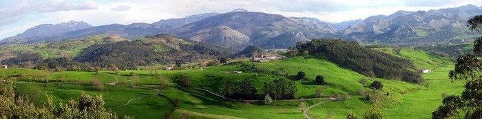
In Auvergne, General Council of Puy-de-Dôme sustains inscription of the site « Chaîne des Puys – faille de limagne » as a natural site. It is justified by geological arguments (criterion VIII) and landscape (Criterion VII). If the visitor can also easily understand these places today, it is because of how local societies have managed for thousands of years. The research, based on a review of sedimentary and historical sources show that agricultural and forestry practices have left very discrete marks on the volcanic forms by a suitable occupation of land, and these activities are still essential for the understanding of the geological formations.
In the project of registration on the Unesco list (criteria IV and V considered) of the « Clos masures » of the Pays de Caux, the General Council of Seine -Maritime led to the creation of a scientific board that combines various disciplines. From its beginning, it is based on the analysis in the long-term development, the planimetric morphology and consideration of inheritance, including legal. Origins of « clos masure » remains to be explained. Their functioning is related to farming systems of the Middle Ages and modern times. Structuring for the territory, « clos masures » lost during the twentieth century their first features. Today, the desire to bring together researchers from different backgrounds is as important as the strict registration process.
Mainly, with these two examples, we show that reconstruction with a good accuracy of the history of environment can help managers in their jobs, not longuer in a protective and precautionary meaning but in a continuation of the historical dynamics. On the one hand research shows that the current landscape is the product of a long evolution, and each time has left its own mark, used again or ignored by following societies. On the other hand, our research question the limits of the concept of « site » (natural site, cultural site …) carried by international institutions and the need of preservation. In the case of « Chaîne des Puys », as for « Pays de Caux », the procedure and the future management plan are ready to go beyond the logic of protection. They can enhance the visibility of geological forms or old lanscape planning by directing agricultural and forestry uses without jeopardizing their production activity. This atypical feature brings to imagine new way of management, as opposed to the Wilderness, or strict conservatory approach, respecting past and present human activities and orient them towards « cultivate » the natural or cultural aspect that give the universal value.


Aucun commentaire:
Enregistrer un commentaire